|
Additional Details:
- 01, 02, 03 -
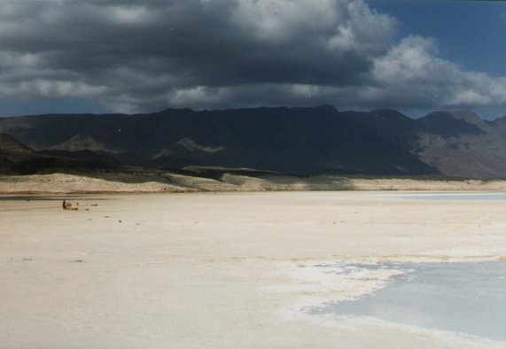
Asal Lake - a lake 150 m below sea level (the point of lowest
altitude on the African continent) with a salt content 10 times
higher than sea water. As the salt evaporates, it forms the
white crystals which can be seen in the foreground. The
crystals are hard and sharp and extremely painful to walk on.
In photo 01, the sandy color comes from dust blown over the salt.
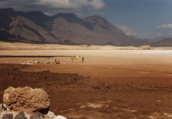
- 04 - Caravans of camels come to Lake Asal to
harvest the salt and take it to markets hundreds of kilometers
away. Difficult work in a difficult climate - this is one of
the hottest places on Earth. The heat causes the water to
evaporate at such a rate that scientists estimate there will be no
more lake here by the year 2010.
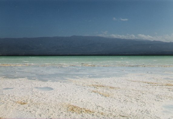
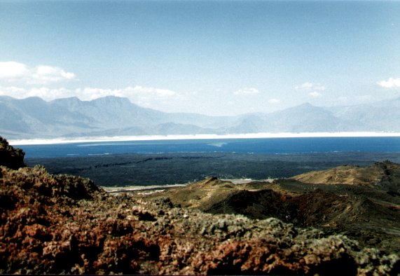
- 05 - Of all the photos I took in Djibouti, this
one is my favorite. It shows crystallized lava flows in the
foreground, a crack in the earth just in front of the water, showing
where two continents are being ripped apart, and the Asal Lake with
its white crystals of salt all around showing that the level of the
lake is constantly dropping.
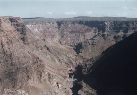
- 06 - This canyon is only about 60 meters deep but
it shows the powerful cutting force of erosion by water. This
allows us to see the many layers of rocks below the surface.
The horizontal lines (called strata) are successions of deposits of
either lava or sedimentary rocks.
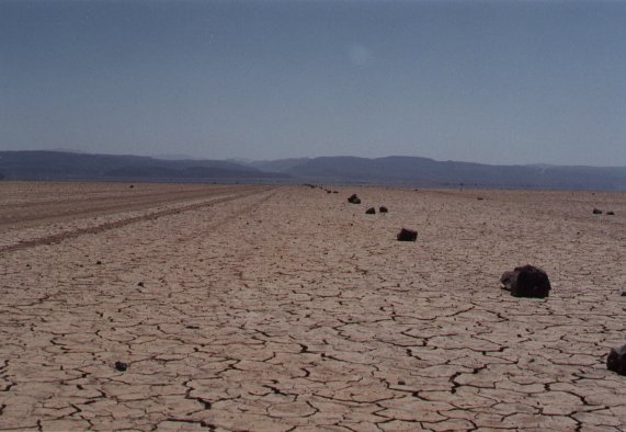
- 07 - Djibouti is a very arid country. Le
Petit Bara is one of the more arid places in Djibouti where the
mudflats show the characteristic cracks from evaporation. The
stones placed on the right are to show where the road is when all
traces of it have been erased by the wind.
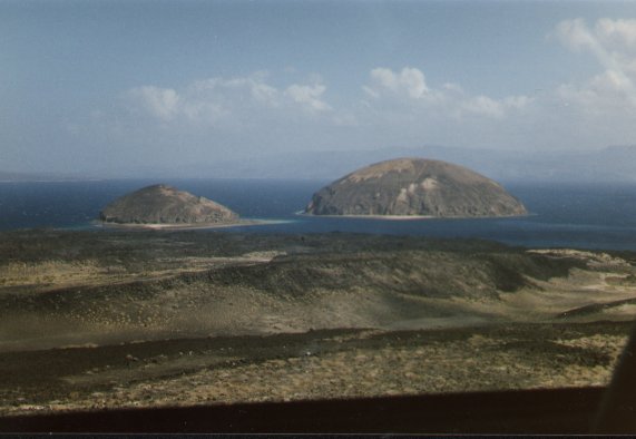
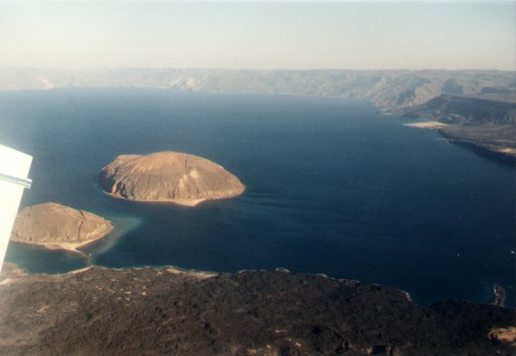
- 08 - Les Iles du Diable (Devil's Islands)
are two volcanoes which were formed underwater. Since the
level of the water has gone down, they are visible now.
- 09 - Les Iles du Diable (Devil's Islands)
seen from an airplane.
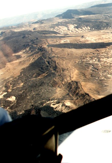
- 10 - The step-like silhouette seen on the horizon
shows that this region is being pulled apart as two tectonic plates
are separated. Notice how the "steps" go down from
left to right until they get to the low point in the middle and then
they go back up. The lowest point in the middle is where the
two plates are separating. In millions of years, an ocean will
separate them.
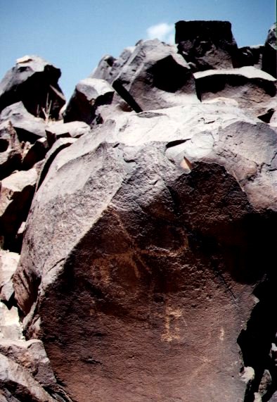
- 11 - These rock paintings are thousands of years
old. They prove that humans occupied these lands long ago.
- 12 - The cracks in the Earth's surface seen here
are due to tectonic plates separating. As they are pulled
apart, magma rises to the surface to form volcanoes. It is
possible to see dark patches on either side of the cracks - these
are old lava flows where the hot liquid was able to escape to the
surface. Just above the middle of the photo and to the left of
center, the cracks end and there is a little cone. This is the
volcano Ardukoba which had the most recent eruption in Djibouti's
history (1978).
|